| |

EXPERIENCE, KNOWLEDGE, SYNERGY. |
ABOUT
|
SERVICES
|
PUBLICATIONS
|
|
|

|
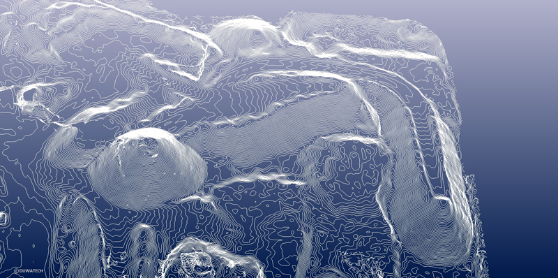
Digital Elevation Model (10 meter contours) of Compost stockpile. The image, produced from an Aerial Photograph taken by UAV, was used to quantify material in the stockpile
Aerial Surveys
TEM Network Ltd., in association with Duwatech Inc., offers state-of-the-art survey and monitoring tools using advanced Unmanned Air Vehicle (UAV) technology. These tools can provide, in particular, engineering-grade surveys at a much reduced cost when compared to conventional methodologies. Services include but are not limited to:
• low-altitude high-resolution aerial surveys
• close-range photogrammetry
• infrastructure inspection and geographical mapping